Sargassum forecast map · Public beta
See where sargassum seaweed is heading, before it reaches the beach.
Satellites spot floating sargassum across the Atlantic, Caribbean and Gulf of Mexico. We drift it forward with ocean-current and wind forecasts to show which shores are likely to receive seaweed in the next 3 days.
- 3-day drift & beach-landing forecast
- 12-month History playback
- 87 region forecast pages
- Free to use
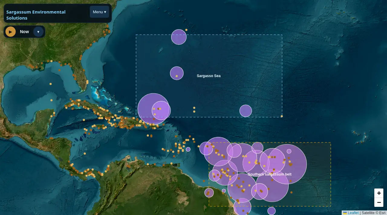
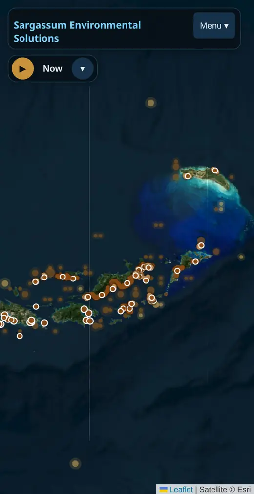
Real screenshots of the map: whole Atlantic (desktop) and British Virgin Islands (phone), forecast data of 18 October 2026.Real screenshot of the map on a phone: British Virgin Islands, forecast data of 18 October 2026.
What it does
One map for floating seaweed: where it is, where it's going, where it's been.
Sargassum mats drift for weeks across the Atlantic before they land. The map brings the satellite record, a short-range drift forecast and on-the-ground reports together in one place, on desktop and phone.
Satellite weed detections
Floating sargassum seen by satellites across the Atlantic belt, the Sargasso Sea, the Caribbean, the Gulf and Florida.
3-day drift & beach-landing forecast
Where today's weed is carried over the next 72 hours, and which named shores it is likely to reach, with a shore-by-shore list for the BVI.
History playback
Week-by-week playback of up to 12 months of satellite sightings, following mat families as they drift, split and merge into the Caribbean.
Region forecast pages
87 pages, from single islands to whole coasts: next 72 hours, 30-day and 3-month outlooks, coasts most at risk and satellite history since 2016.
Beach reports & webcams
Reports from people on the shore and public beach webcams, shown on the map and used to check the forecast.
How it works
From satellite pixels to a beach forecast, in plain language.
Every piece of input data is public. Here is what happens between a satellite pass and the coloured markers on the map.
Satellites spot the weed
Floating sargassum reflects near-infrared light differently from open water. We use NOAA AOML's daily, 3-day and 7-day weed-index maps (built from the MODIS, VIIRS and OLCI ocean-colour sensors) and, for the whole Atlantic belt, Copernicus Marine. Around the BVI, finer 20 m Sentinel-2 images add small rafts.
Currents and wind move it
Hourly surface-current forecasts (Copernicus Marine, Météo-France SMOC and HYCOM, all about 9 km resolution) carry the weed, and a few percent of the wind speed (NOAA GFS or Open-Meteo) pushes it as it floats.
Many runs, not one guess
The drift is simulated 7 times for 72 hours, each run with slightly different wind and current settings. A track stops where it meets the coastline (GSHHG full-resolution shoreline). Shores reached in more runs get a stronger marker.
Kept fresh
A daily job refreshes the ocean-current data and re-tunes the model against recent satellite views and beach reports. The map's forecast is rebuilt from the latest detections at most every 3 hours.
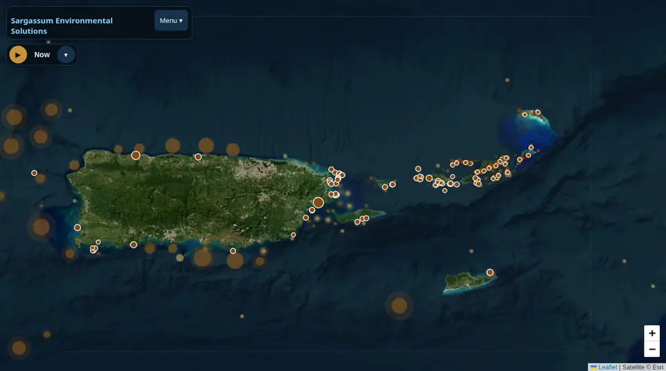
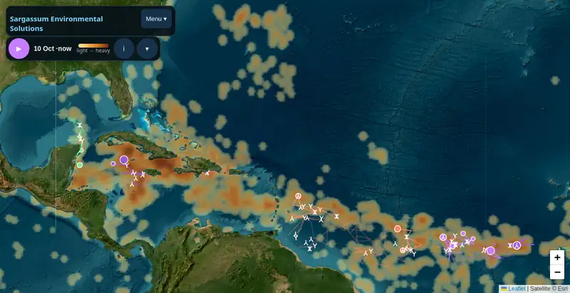
Forecasts are estimates, not guarantees. Clouds hide weed from satellites, thin mats can be missed and the model only looks 72 hours ahead. Always check local conditions. Methods & data sources
Why it matters · Who it's for
Seaweed on the beach costs a day, a booking or a clean-up crew.
Mats that land and rot give off hydrogen sulfide and ammonia, the rotten-egg smell (US EPA, PAHO). Knowing a few days ahead helps people plan where to go, when to clear a beach and when to warn guests.
- Hotels & beach managersSee which shores are likely to receive weed and plan clean-ups.
- Boat, dive & tour operatorsPick anchorages and beaches with less weed for the days ahead.
- Residents & visitorsCheck a beach before you go, and report what you see.
- Researchers & agenciesA year of tracked mat movement and per-region charts in one place.
Public forecast pages
Sargassum forecast by region
Each region page is free to read without an account: next 72 hours, 30-day and 3-month outlooks, the coasts most at risk and satellite history.
Virgin Islands & Puerto Rico
Lesser Antilles
Hispaniola
Turks & Caicos
Bahamas
Jamaica & western Caribbean
Florida & Keys
Gulf of Mexico
Southern Caribbean & Guianas
Bermuda & US East Coast
Mexico Caribbean coast (Quintana Roo)
Yucatán Peninsula
All countries, islands & districts
Open the map
Create a free account or log in.
The full interactive map is free. An account lets you open it, report a beach and save your favourite map layers.
- Sign up with just an email and password
- We only use your email for your login
- Region pages stay open to everyone